Reach 3 is the most downstream reach in this study which lies in the Southern part of the Little Bear watershed and flows through the alluvial deposits of Cache valley. The study reach has a straight length of about 2 km. The reach is located a few kilometers upstream from the confluence with the Logan river. Location of the reach in the catchment context is shown in Figure 15. Please click this link to view the study reach in google earth web. At this reach the terrain is extremely flat and the river flows from south to north with relatively small velocity.
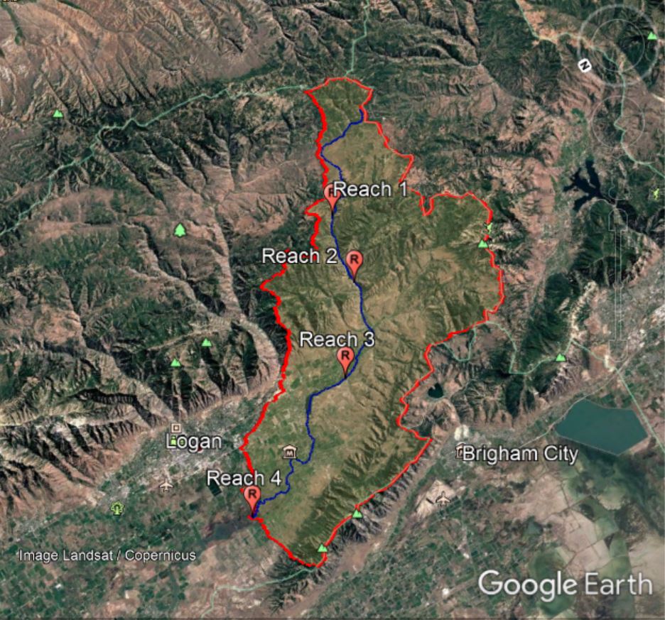
Figure 15: Location of reach 3 in catchment context
|
|
The catchment area upstream of the Reach 3 is approximately 774.16 square kilometers. Simailarly, the elevation at the upstream and downstream point of reach 3 are 1345masl and 1344.8 masl respectively. Which means the river at this reach has an extremely mild slope which is around 0.005%.
The valley margins are extremely far away from the river reach and hence it is fully unconfined (Figure 17). The anthropogenic confinements are also absent in this reach. It has very large floodplains and its inundation extent depends on the discharge in the river. The normal flow width ranges from 20 to 30 meters.
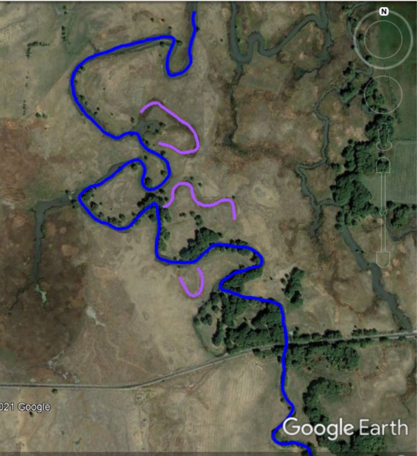
Figure 16: Meandering river channel in reach 3 with some old channels
A typical cross section at the reach is given below. A number of channels on either side exhibits its large connectivity to the floodplain. It has the tendency of lateral movement through the simultaneous process of lateral erosion and deposition at the outer and inner bends respectively. Lateral movement is far dominant than the vertical movement of the channel bed.
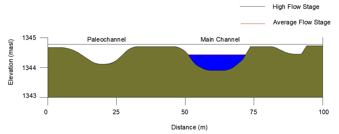
Figure 17: Typical cross section of reach 3
The reach mostly has a single thread channel as shown in figure 16 and meanders through the agricultural land with a sinuosity of 2.4 which can be considered high. The soil in the reach is mostly fine clay/silt with vegetation which is most suitable for the river for meandering. Historically the reach exhibits lateral movement evident from the traces of paleochannels and meander cutoffs. The river flows mostly in the form of continuous pool of water which can be both due to the backwater effect of the Cutler reservoir and also due to the flat terrain itself.
The river bed is predominantly find sand and clay as its formed in the remains of the ancient Boneville lake. Moreover, the slope is too small to have large boulders and gravel. Two major reservoirs in the upstream prevents the supply of coarser bed load sediments to this reach. No major tributary drains to the river after downstream of the reservoirs.
The river bed is predominantly find sand and clay as its formed in the remains of the ancient Boneville lake. Moreover, the slope is too small to have large boulders and gravel. Two major reservoirs in the upstream prevents the supply of coarser bed load sediments to this reach. No major tributary drains to the river after downstream of the reservoirs.
This reach has the tendency to adjust laterally. In future, it can be expected that the river might meander and some meander cutoffs can occur. It will also depend how this reach is impacted anthropogenically. As the floodplains are the agricultural lands now, it can be expected that the reach might be modified and the banks can be strengthened. If there are no human interventions, its highly possible that the river will flow exhibit lateral movements.
